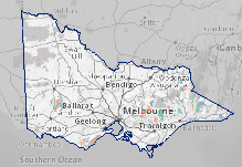
Joint Fuel Management Program
The Joint Fuel Management Program is a state-wide program that manages fuel on public and private land over the next 3 years. The program integrates a risk-focused bushfire management approach.
Forest Fire Management Victoria (FFMVic) and Country Fire Authority (CFA) commits to work as one sector by sharing resources, vehicles, and other equipment. The program is a significant step in implementing the Safer Together program.
FFMVic and CFA staff have developed the program in consultation with local councils, wineries, tourism industry, beekeepers, flora and fauna specialists, and knowledge from local communities including Traditional Owners, key stakeholders and any other parties who registered their interest.
FFMVic has delivered ~1,500km of Strategic Fuel Breaks across Victoria over the last few years and is now funded to maintain these breaks. Maintenance of Strategic fuel breaks are included in this JFMP as routine non-burn fuel treatments, such as slashing and mowing treatments.
The Joint Fuel Management Program (JFMP) is updated each year with the latest information and built on the latest long term Bushfire Management Strategies.
More information on CFA planned burns.
Why we burn
Burns are required for various reasons across both private and public land, including:
- reducing bushfire risk
- reduce bushfire size and severity
- aid bushfire suppression efforts
- reduce the ignition likelihood in areas where large bushfires are modelled to start
- flora and fauna ecological requirement
- regeneration
- land management
- agricultural purposes.
Cultural burning
Traditional Owners have nominated and will carry out all cultural burns, with support from FFMVic and CFA. Approximately 111 cultural burns are identified for 2024-2025.
Cultural burning is led by the Traditional Owners of that Country, and done for a variety of purposes, including ceremony, protection of cultural and natural assets, fuel reduction, regeneration and management of food, fibre and medicines, flora regeneration, fauna habitat protection and healing Country’s spirit.
Maps and plans
Each region has provided maps and plans below that explain how long-term strategic planning is guiding the development of the program. Each map and plan show projected bushfire risk and ecological outcomes over the next 3 years.
For details of fire operations activities in each DEECA or CFA district, including burn locations, use our interactive map or download the documents or pdf map below.
The program is designed to be flexible, allowing the timing of proposed activities over the three-year period to change in response to weather and other conditions. This means activities such as burns may be carried out in a different year than indicated in the maps and plans.
Fuel management activities include planned burns and mechanical works such as slashing, mowing and clearing works, creating and maintaining fuel breaks.
We welcome your comments all year round and we encourage you to have input into all parts of the strategic and operational planning process. Please contact your local DEECA office, Parks Victoria or CFA.
For information about public safety zones, visit closures of parks and forests.
Program amendments
On occasion, it is necessary to modify activities including changing burns, rescheduling burns, or removing or adding new burns to the Joint Fuel Management Program.
2025-26 Joint Fuel Management Program amendments (DOCX, 129.5 KB)
Amendments will not be added to or removed from the files and pdf maps available for download below.
Interactive map
See CFA and FFMVic planned burns and other fuel management activities.

Use this ![]() to select the information you want to see.
to select the information you want to see.
Not sure what region or district you're in CFA Districts/Regions OR DEECA District Regions, or contact our Customer Service Centre on 136 186.
Live JFMP Map
This JFMP Map map shows the latest approved burns and treatments (including recent amendments).
Zoom in to an area of interest, the map first shows the 3 Year Joint Fuel Management Program. With more information about mechanical treatments and fire management zoning displayed as you scroll down.
Get notified
You can register on Planned Burns Victoria to receive notifications when burns in your selected areas are close to being carried out.
Download plans and maps
The table below shows the Joint Fuel Management Program across Victoria. Detailed maps are attached and provided in both CFA and DEECA district format.
(maps show JFMP as signed off 31 October 2025)
Page last updated: 27/11/25
